
Last Updated: September 14, 2021
Best Views in the Smoky Mountains: In Every Season
A part of the larger Appalachian range, the Great Smoky Mountains get their name from a natural fog that hangs over the hills appearing as plumes of smoke in the distance. The fog is the result of volatile organic compounds emitted from all of the vegetation. These time-worn hills stretch across the border of North Carolina and Tennessee in the southeastern US.
In this part of the world, “old as the hills” is a common phrase you’ll hear from the Appalachian folks. And old they are! In the geological span of time, the tall peaks of the Himilayas are babies at “only” about 40 million years old.
The Smoky Mountains offer breathtaking scenery in every season. Billions of hardwoods start the spring with shades of pale green that turn to a brilliant patchwork of color in the fall. Winter brings scant snowfall, and the leaves disappear for even more spectacular views.
The best views in the Smoky Mountains can be experienced by hiking, scenic drives, sky lifts, and observation towers.
Table Of Contents
Show All
Great Smokies Hikes
Rainbow Falls
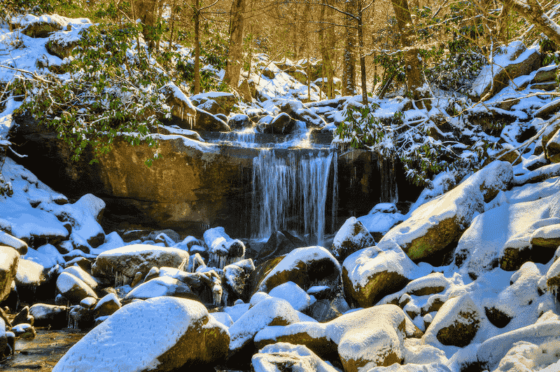
Image courtesy of Michael Hicks
A moderate to difficult hike, the Rainbow Falls hike is one of the best in the Smoky Mountains National Park. The loop trail runs for about 5.4 miles and features views of an 80-foot-high waterfall. Between the trailhead and the falls, the altitude gain is about 1,500 feet. You’ll come upon the falls about 2.5 miles from the trailhead.
On sunny afternoons after a long rainfall, the mist produces a dramatic rainbow. In winter, ice forms around the falls. Most people turn around here, but the trail eventually leads to the summit of Mt. LeConte, the third-highest peak in the Smokies for more great views.
Rocky Top and Spence Field
The views from Rocky Top are among the most spectacular in the Smokies. To get there, take the Anthony Creek Trailhead in the national park’s Cades Cove picnic area. The best time to make this 13.9-mile roundtrip hike is in late spring when the mountain laurel is in bloom at Spence Field.
You’ll want to stop for a rest and take in the scenery here, but the views get even better if you continue on the trail for another 1.2 miles to Rocky Top. From the summit, you can see Cades Cove, Fontana Lake, and beyond.
Clingmans Dome
The hike to Clingmans Dome is an easy one and only 1.2 miles round trip. However, it’s a steep one because of the elevation gain. An observation tower sits at the highest point in the Great Smoky Mountains National Park for 360-degree views. It’s a popular place to go for sunrise or sunset views. You can see for about 100 miles on clear days.
Sky Lifts and Observation Towers
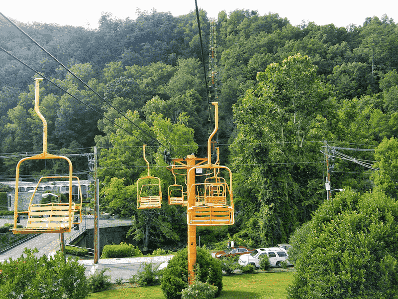
Image courtesy of Wikimedia
For breathtaking views without a long hike, the town of Gatlinburg, Tennessee is the best place to go. The chairlift at SkyLift Park has been taking visitors 1,800 feet to the top of Crockett Mountain since 1954. Once at the top, visitors get off at the SkyDeck for views, and to have a beer and browse the shops at SkyCenter.
Gatlinburg’s SkyBridge is the largest pedestrian suspension in North America. It spans 680 feet from tower to tower and is 150 feet high at the midpoint where you will walk over glass panels for 30 feet. With a ticket to SkyLift, visitors have all-day access to the SkyBridge and SkyCenter.
The Ober Gatlinburg Aerial Tramway is another way to experience spectacular Smoky Mountain views. The tram begins at 1,341 feet and reaches a high point at 2,813 feet above sea level.
It was established in the winter of 1972 to provide a safe and comfortable way to reach the ski areas in the region. The two 120-passenger counter-balance cars depart from downtown Gatlinburg and reach an amusement park and ski resort. Visitors can ride up and back or hang out to eat and play.
Scenic Drives
Newfound Gap Road
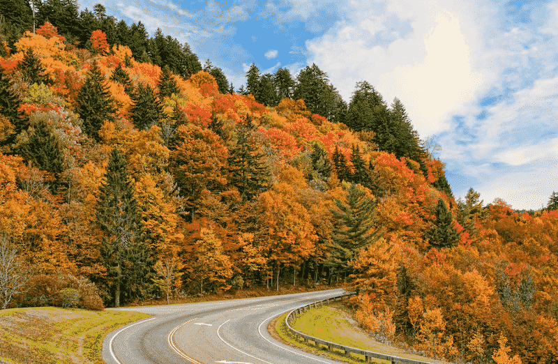
Image courtesy of Timothy Wildey
Leading to the gap of the same name, Newfound Gap Road (US-441) is a high mountain pass on the state line of North Carolina and Tennesee in the national park. The famed Appalachian Trail with a southern terminus at Springer Mountain, Georgia passes through here and ends in Maine. This classic drive begins at an elevation of 1,289 feet in Gatlin burg and climbs to 5,046 Ft at Newfound Gap.
From here motorists descend to Cherokee, NC at an elevation of 1,991 ft. Visitors will see a variety of forest types along the way from hardwoods to spruce-fir forests along the higher elevation ridges. Several overlooks along the way provide sweeping mountain views.
Little River Road
Little River Road is a 25-mile-long scenic highway that connects Gatlinburg’s Sugarlands Visitor Center to the Cades Cove region of the Smokies. It follows along Little River through hardwood forests. The drive consists of Fighting Creek Gap Rd, Laurel Creek Rd, and Little River Gorge Rd.
It’s the best of the lower elevation roads for exploring Tennesee’s side of the national park. Impressive sights along the way include Metcalf Bottoms, Tremont, Elkmont, and the Townsend Wye swimming area.
You’ll also see the Sinks Waterfall by the roadside and pass by the Laurel Falls Trail. There are numerous pull-offs for enjoying the views. Once in the Cades Cove region, there is a lush valley populated with historic cabins.
About the Author Anna Timbrook
Anna is the co-owner of expert world travel and can't wait to share her travel experience with the world. With over 54 countries under her belt she has a lot to write about! Including those insane encounters with black bears in Canada.
