
Last Updated: November 3, 2021
Best Views in Lake Tahoe (Perfect For Sunset)
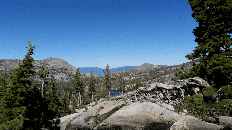
Straddling the border of Nevada and California, Lake Tahoe is a sapphire blue jewel in the snow-capped Sierra Nevada Mountains. With a depth of 1,645 ft, it’s the second deepest lake in the United States (after Crater Lake in Oregon.) The lake is huge with a surface area of 190 square miles and is 12 miles wide and 22 miles long.
One of the premier tourist destinations in two states, the lake offers a wealth of outdoor adventures all year long among some of the country’s most stunning scenery. Here are the best ways to admire the views around beautiful Lake Tahoe.
Table Of Contents
Show All
Scenic Drives and Overlooks
Lake Tahoe Scenic Drive
The Lake Tahoe Scenic Drive is a well-maintained paved road that loops around it for 68 miles. Because it’s a loop, the drive can begin at any point and includes many scenic overlooks. The route follows the US 50, NV 28, US 89 highways and passes through the popular towns of Tahoe City, South Lake Tahoe, King’s Beach, and several other smaller towns.
Rather than following the lake’s shoreline, the road runs back and above from just 50 yards to a mile or more. Most of the road is always open weather permitting. One exception is a short section of US HWY 89 on the lake’s west shore on the California side.
Emerald Bay State Park Lookout

Emerald Bay State Park is one of the most photographed parts of Lake Tahoe. The park is one of the most popular places around Lake Tahoe and is a natural national landmark.
The lookout is located at the southwestern tip of the lake. Parking is limited, so arrive early to snag a spot for some of Lake Tahoe’s best views. From the parking lot, you can also take a short hike to Eagle Falls with water cascading over granite cliffs and more rewarding views along the way.
Inspiration Point
Aptly named, Inspiration Point affords views of Emerald Bay and Fanette Island from a higher vantage point. Located about 10 miles from the town of South Lake Tahoe along Hyw 89, it’s a must-stop for capturing great photos.
The viewpoint faces east, so the sun rises over the lake and casts lovely colors reflecting on the lake. The Sierra Mountains in the background create a sunstar as the sun comes up.
Inspiration Point is easy to get to, and the pull-off can safely accommodate up to six cars. There is also a short hike you can take from here that leads to Eagle Falls.
Emerald Bay Viewpoint
Although it’s only a half-mile up the road, Emerald Bay Viewpoint gives you views of the lake from a different perspective. Photographers can get stunning straight-on pics from 600 feet above the lake. Pine-covered points rise up 1,000 feet higher. You can also hike down to the cove and the beach below.
Mount Rose Highway Scenic Overlook
This scenic overlook is located four miles from Incline Village in North Lake Tahoe. Mount Rose Highway, part of NV Hwy 431, leads from Lake Tahoe to Reno, Nevada. At a height of 7,562 feet above sea level, it’s one of the best places for panoramic views of the lake. Continuing north on this scenic route, you will come to the highest summit in the region (8.911 ft) that is open all year.
An interpretive kiosk at the overlook gives the name and elevation of surrounding mountain peaks and other points of interest. You can mix in some culture with your viewing by stopping by the Mark Twain Cultural Center in Incline Village.
Memorial Point Scenic Overlook
After leaving Mt. Rose Overlook, head to Memorial Point Overlook on Hwy 28 between Sand Harbor and Incline Village. This scenic overlook has expansive views of Lake Tahoe. The bird’s eye view shows the color gradations of the lake. The deeper parts will appear as a deeper hue. Huge granite boulders frame the shoreline.
The overlook also sits along the Tahoe East Shore Trail, a 2.6-mile hike between Sand Harbor and Tunnel Creek. There is a visitor’s center at the parking lot, and parking is free. A quicker trail leads to the shore and is marked with information posts explaining the area’s wildlife and fish habitats.
Scenic Hikes
Lake Tahoe has hiking trails that radiate In all directions at varying levels of difficulty. All of them have great views to reward your efforts.
Mount Tallac
Experienced hikers can get some of the most rewarding scenery by hiking to the top of Mount Tallac near Emerald Bay. The trailhead is on Hwy 89 between Emerald Bat and Camp Richardson.
The 9.5-mile round trip hike is difficult but offers breathtaking views of Emerald Bay and the entire south shore of Lake Tahoe. The terrain changes go from forests at the bottom to boulders broken rock fragments at the top.
Tahoe Meadows Interpretive Trail
This hike (1.2 mi round trip) is shorter, easier, and suitable for children and the physically challenged. The trail leads through pine forests, mountain streams, and granite boulders to the summit of Mount Rose. Although the elevation is high (8,740 ft), the trail is level. The trail is located on Hwy 431 west of Incline Village. Plenty of parking is available to the right of the trailhead.
Rubicon Trail
This trail is located on the south shore between Emerald Bay and D.L. Bliss State Park. It’s one of the few trails that follows the shoreline of the lake. The hike is long but fairly easy and has some excellent views of the water from a portion of the sheer drop. From the park, the trail leads to Emerald Bay and the Vikingsholm Castle.
Other Elevated Perspectives
For those who aren’t into hiking and wish to avoid traffic and crowded parking lots, here are the other options for seeing the best views in Lake Tahoe.
Heavenly Gondola

Image courtesy of Wikimedia
Open the year-round, the Gondola Ride over Heavenly Valley isn’t just for skiers. You can hover over areas only accessible by foot for amazing views without breaking a sweat. The fee is small but varies throughout the year. The gondola ride goes to the mountain lodge at Heavenly Resort.
Helicopter Tours
From the shores of Lake Tahoe, visitors realize that this is a huge body of water because you can’t always see land on the other side. But to really get a sense of the vastness of the lake, a helicopter ride is the way to go. Seeing the lake on such a grand scale is breathtaking. The views encompass the entire lake, majestic mountains, and remote beaches.
About the Author Anna Timbrook
Anna is the co-owner of expert world travel and can't wait to share her travel experience with the world. With over 54 countries under her belt she has a lot to write about! Including those insane encounters with black bears in Canada.
